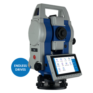
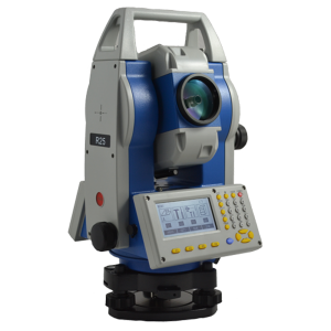
R20 Total Station

0.00

Precise, efficient and easy Total Station

The R20 range is composed of 3 versions, the R20 1000 m model with 2″ angular accuracy, the R20 1000 m model with 1″ angular accuracy and the R20 600 m model with 2″ angular accuracy.

The three models offer optimum performance up to 5000 m with prism and 1000 m or 600 m reflectorless. The entire R20 range is equipped with a high-performance, illuminated reticle telescope that provides the best quality of observation, whatever the environmental conditions.

The programs on board of these models of total stations make them suitable for any work in construction, cadastral, mapping and staking, through a user-friendly interface. Thanks to the presence of Bluetooth connection, it is possible to connect an external controller, giving the possibility to use a customized field software.

Description

LIMITLESS DISTANCE MEASUREMENTS

By using a digital phase laser ranging technology, R20 guarantees high accuracy measurements: 1000 m or 600 m (depending on the model) in reflectorless mode and up to 5000 m using a single prism, with millimeter accuracy.

FAST, ACCURATE, RELIABLE

Measuring distances with high angular accuracy make any job extremely cost effective and reliable. The wide range of application software allows to complete the Surveyor’s tasks directly in the field.

ONE DAY OF CONTINUOUS FIELD WORK

Thanks to the low power consumption circuit design R20 gives the opportunity to continuously work for more than 22 hours.

TEMPERATURE PRESSURE

Variations in temperature and pressure have a negative impact on the accuracy of distance measurements. R20 allows setting the values of temperature and pressure to ensure the precision of distance measurements.

Specifications

ANGLE MEASUREMENT
Accuracy1 1″ / 2″
Reading System Absolute Encoder
Display Resolution (Selectable) 1″ / 5″ / 10″
0.0001 g / 00005 g / 0.001 g
0.01 mil / 0.05 mil / 0.1 mil
Angle Units DEG 3600/GON 400/MIL 6.400

TELESCOPE
Magnification / Field Of View 30x/1030′
Tube Length 160 mm
Minimum Focus Distance 1.7 m (5.6 ft)
Reticle Illumination 4 levels
Objective Aperture 44 mm
Laser pointer Red light, Coaxial

TILT SENSOR
Type Optoelectronic, dual axis
Compensation Range/Accuracy ± 4.0’/3″

DISTANCE MEASUREMENT RANGE2
Prism Mode 5.000 m3
Reflective Sheet (6cm x 6cm) 800 m3
Reflectorless6 600 / 1000 m4

DISTANCE MEASUREMENT ACCURACY5
Prism 2 mm + 2 ppm
Reflectorless 3 mm + 2 ppm

MEASUREMENT TIME
Prism (Tracking/Fast/Fine) 0.3/0.5/0.8 sec
Reflectorless ≥ 3.0 sec

DISTANCE MEASUREMENT
Distance Unit m/US-ft/lNT-ft/ ft-in1-16
Display Resolution 0.001m
0.01ft

LASER PLUMMET
Carrier Wave 635nm
Accuracy ± 1.5mm / 1.5 m
Spot 2.5mm/l.5 m

LEVEL VIAL SENSITIVITY
Plate Level 30″/2mm
Circular Level 8’/ 2mm

ENVIRONMENTAL CONDITIONS
Operating Temperature -200C +500C
Storage Temperature -300C +600C
Waterproof/ Dustproof IP65

PHYSICAL SPECIFICATION
Dimensions 365 x 195 x 169 mm
Weight Including Battery and Tribrach 5.6 Kg

POWER
Battery Voltage/Capacity 7.4V/2600mAh Li-ion
Operating time
(angle measurement)
22 hours
Operating time
(angle+dist. meas. every 30 s)
19.5 hours
Battery Charger 100/240V, charging time 3h

OTHER SPECIFICATIONS
Display Two sides, LCD 320 x 240
Dots / Alphanumeric
Memory > 80.000 Points
Interface USB 2.0 / Bluetooth 5.0
Temperature / pressure Custom setting possible

ON BOARD FIELD APPLICATION PROGRAMS
Data recording and management, Stake out, Offset, MI_M, Remote height, Area, Resection, Reference line

Datasheet

Geode works with a wide range of Windows®, Windows Mobile, and Android® devices to fit your needs exactly and is especially useful for bring-your-own-device workplaces. Take the Geode with you mounted on a pole, in a pack, or held in your hand to collect real-time sub-meter GNSS data in harsh environments, using almost any handheld device. please download Datasheet.

Download Data Sheet

Accessories